


St Stephens School was at the heart of the community during a decade of social and economic change. The photo is one of 18 which provides an intriguing glimpse into life around LS9 and features shops, landmarks and streets, some of which were demolished as part of slum clearance, from back in the day. The images are published courtesy of West Yorkshire Archive Service, which collects and looks after the unique documentary heritage of the region dating from the 12th century to the present day - more than 800 years of local history. It also runs Catablogue, an online blog dedicated to preserving the past, serving the present and protecting the future.READ MORE: Fascinating photos of Leeds city centre during the 1960s LOVE LEEDS? LOVE NOSTALGIA? Join Leeds Retro on facebook
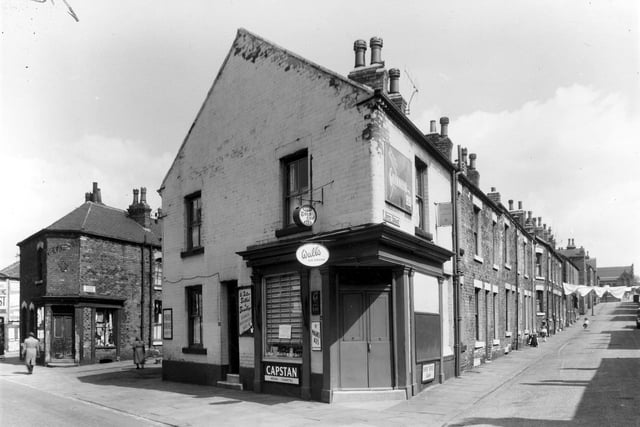
1. Burmantofts in the 1960s
A corner shop on Accommodation Road in May 1960. Photo: West Yorkshire Archive Service
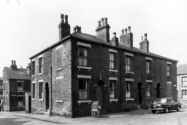
2. Burmantofts in the 1960s
Fertile Terrace pictured in May 1960. It was located between Nippet Terrace, seen here on the left and Perth Street to the right. Photo: West Yorkshire Archive Service
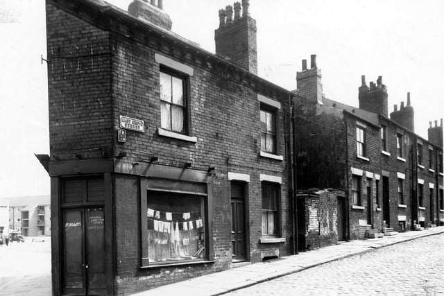
3. Burmantofts in the 1960s
A shop is on the corner with East Grove Street in May 1960. To the left is Accommodation Road, a block of new Council maisonettes can be seen. This building work was carried out at the same time as the demolition of the old street. Photo: West Yorkshire Archive Service
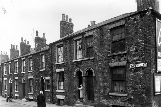
4. Burmantofts in the 1960s
A woman stands at the door of a derelict house on East Beckett Street in May 1960. The property was to be included in clearance area, Photo: West Yorkshire Archive Service
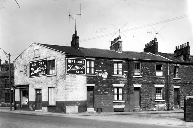
5. Burmantofts in the 1960s
A grocers and off licence shop on the corner of Nippet Lane in May 1960. On the left edge East Beckett Street can just be seen. Photo: West Yorkshire Archive Service
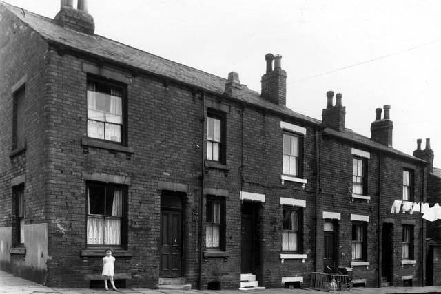
6. Burmantofts in the 1960s
A little girl is standing outside a house on Leith Street in May 1960. Photo: West Yorkshire Archive Service