
They take you around the city during the decade but can you add a specific date to any of the wonderful photos which provide a fascinating glimpse into life around Leeds at a time of enormous social and economic change. Suburbs in focus include Armley and Bramley in west Leeds, Middleton and Beeston in south Leeds and Crossgates in east Leeds. The images are published courtesy of photographic archive Leodis, which is run by Leeds Library & Information Service. They also run heritage blog The Secret Library Leeds, which provides a behind the scenes look at the Central Library and highlights from its special collections, including rare books hidden away in the stacks. READ MORE: 25 Leeds pubs you may remember from the 1980s LOVE LEEDS? LOVE NOSTALGIA? Join Leeds Retro on facebook
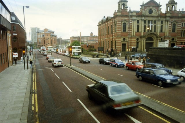
1. Leeds circa 1980s
Looking west along The Headrow, towards Westgate, which begins after the junction with Oxford Place, located in front of Oxford Place Chapel which dominates the right-hand side of the image. This is now known as the Oxford Place Methodist Centre. To the left of it, between the junctions of Oxford Row and Park Street is Leeds Combined Court Centre. The red brick building with large glass windows at the junction with Park Street and Park Lane is the Magistrates Court. Behind it the 1966 high rise residential block, Marlborough Towers is visible. Photo: David L. Thompson
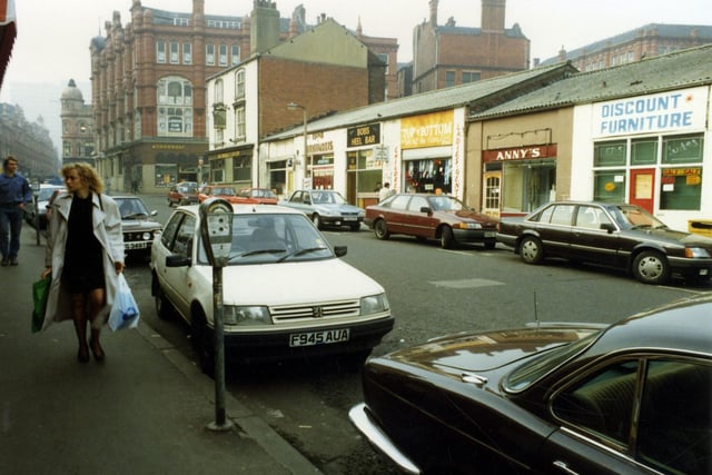
2. Leeds circa 1980s
George Street looking in the direction of Ludgate Hill and Vicar Lane. The red brick building at the left edge once housed the department store, Willis Ludlow's. The tall white rendered building is the Market Tavern of number 1 George Street, which stands at the junction with Harewood Street. The small, single storey shop premises and the Market Tavern are now demolished and the area is used for car parking (2012). Plans are in place to build a huge new retail development on a site which includes George Street, Harewood Street and Eastgate, bordered by the Inner Ring Road, Vicar Lane, Kirkgate Market and the West Yorkshire Playhouse. It is presently to be called 'Eastgate Quarters'. Photo: David L. Thompson
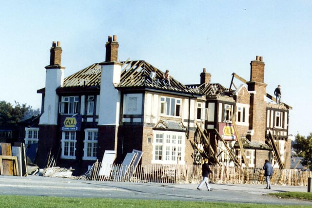
3. Leeds circa 1980s
The Melbourne Hotel public house in the process of demolition. This site at the junction of York Road to the left and Foundry Lane (to the right) has since become occupied by a Burger King fast food restaurant. Photo: Leeds Libraries, www.leodis.net
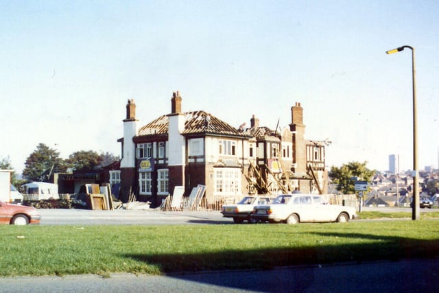
4. Leeds circa 1980s
Another photo looking across the dual carriageway of York Road towards the Melbourne Hotel public house in the process of demolition. The junction with Foundry Lane is to the right. The site is now occupied by a Burger King fast food restaurant. Photo: Leeds Libraries, www.leodis.net
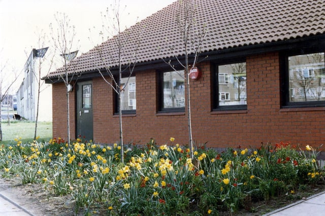
5. Leeds circa 1980s
The former Richmond Hill Branch Library, situated on York Road and opened in 1983. In 1995 it was relocated to new premises in Richmond Hill Sports Centre on Pontefract Lane. Photo: Leeds Libraries, www.leodis.net
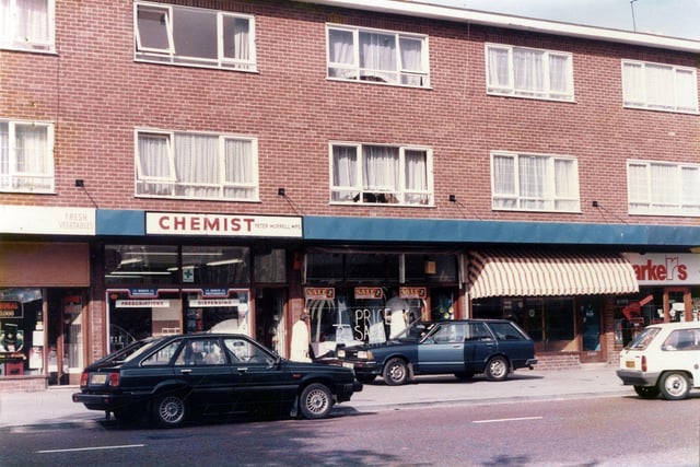
6. Leeds circa 1980s
Part of a parade of shops on Upper Town Street in Bramley. They include Peter Morrell, chemist. Photo: Leeds Libraries, www.leodis.net