Blizzard conditions as Cookridge blanketed in heavy snow fall - as these photos and video show
and live on Freeview channel 276
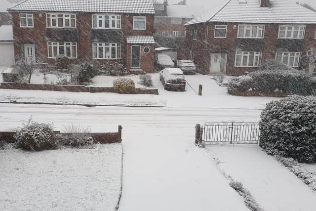
Heavy snow has come down in Cookridge, blanketing roads and driveways and making much of the area totally impassable.
Thick snow is falling fast, settling on roads and in gardens, after first beginning to fall at around 7.30am.
Advertisement
Hide AdAdvertisement
Hide AdOther parts of Leeds have also seen snow including Kirkstall and Alwoodley, but Cookridge and Horsforth seem to have it the worst as of 9.30am.

Here is the forecast in full:
Friday: "Outbreaks of rain, sleet and snow moving south across the region during the morning. Snow settling to some low levels. Risk of some icy stretches forming in places. It will become drier and brighter into the afternoon. Feeling rather cold. Maximum temperature 2 °C."
Friday night: "Mostly dry with lengthy clear skies inland overnight. A widespread frost with the risk of icy stretches forming. A few light showers are likely along the east coast. Minimum temperature -4 °C."
Saturday: "After a cold and frosty start, it will be mostly fine and dry, with good spells of sunshine. Clouding over from the north later in the day. Feeling rather cold. Maximum temperature 3 °C."
Advertisement
Hide AdAdvertisement
Hide Ad
Outlook for Sunday to Tuesday: "Cloudier and breezier on Sunday with some rain and drizzle. Less cold. Further rain and strong winds moving south Monday, perhaps some hill snow later. Drier and brighter on Tuesday."
Is it snowing where you are? Send us your photos and videos.
Comment Guidelines
National World encourages reader discussion on our stories. User feedback, insights and back-and-forth exchanges add a rich layer of context to reporting. Please review our Community Guidelines before commenting.