Dramatic first pictures of flooding in Leeds as Storm Christoph puts Otley park underwater
and live on Freeview channel 276
An amber weather warning for rain from the Met Office remains in place across Leeds as Storm Christoph hits the UK.
There is a flood alert in force currently for the lower River Wharfe area with flooding of low-lying land and roads possible.
Advertisement
Hide AdAdvertisement
Hide Ad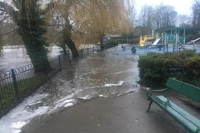

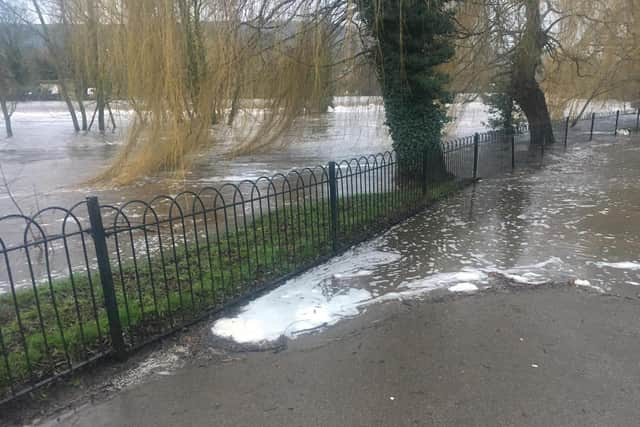
The river has already begun to overflow into a children's playground and a skate park in Otley in Wharfemeadows Park on Farnley Lane.
Pictures, taken at around 8:30am, show the water flooding into the parks from the river.
Local resident Karen Weir lives a two minute walk from the river up a slight hill, so is hoping her home should be safe.
Advertisement
Hide AdAdvertisement
Hide AdShe added: "Luckily we don't flood up the hill on Prince Henry Road but people below the hill on Farnley Lane and Bridge Avenue often do.
"They are quite well prepared though these days.
"There is an Otley Flood Team but they can't go out due to lockdown so builders have provided sand bags for people who need them.
"There's a good community here in Otley and people rally round to help each other."
River levels have been rising overnight and are expected to continue to swell today.
Advertisement
Hide AdAdvertisement
Hide Ad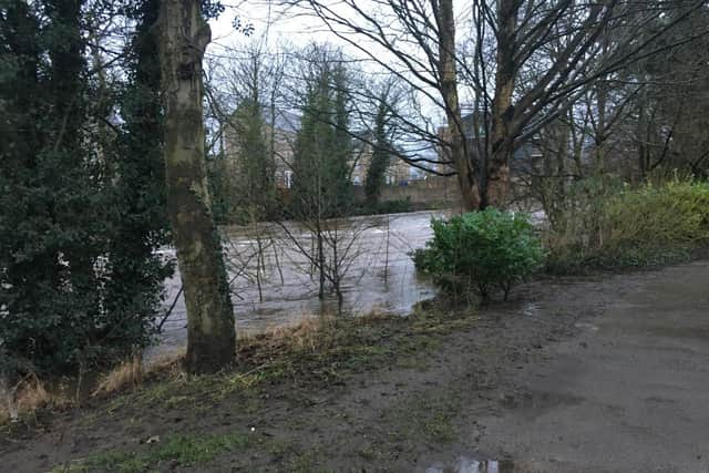
Alerts have been issued for the River Middle Aire catchment, which runs through Leeds, the Lower River Wharfe through north Leeds and Wyke Beck, Meanwood Beck and Wortley Beck.
The Environment Agency is monitoring river levels as further rainfall is forecast today (Wednesday).
Parts of the UK could see two months’ worth of average rainfall in just two-and-a-half days as Storm Christoph moves in.
Advertisement
Hide AdAdvertisement
Hide AdThe amber weather warning for rain in place from the Met Office is the Office's most serious weather warning and has been in place across Leeds since Tuesday morning.
Simon Partridge, a Met Office forecaster, explained: “It’s not a traditional sort of storm, it’s going to be windy but it’s not based on the wind strength at all, it’s really down to the disruption that’s being caused by rain."
Mr Partridge said the storm meant that some areas could see double the average amount of monthly rainfall over a few days.
He said: “Those areas that have seen between 50mm and 70mm already, the warning is out until midday on Thursday, so an extremely long period, but by then we could see up to 150mm to possibly 200mm of rainfall."
What to expect in Leeds, according to the Met Office:
Advertisement
Hide AdAdvertisement
Hide AdHomes and businesses are likely to be flooded, causing damage to some buildings
Fast flowing or deep floodwater is likely, causing danger to life
Delays and some cancellations to train and bus services are likely
Spray and flooding probably leading to difficult driving conditions and some road closures
A good chance some communities cut off by flooded roads
Power cuts and loss of other services to some homes and businesses likely
Comment Guidelines
National World encourages reader discussion on our stories. User feedback, insights and back-and-forth exchanges add a rich layer of context to reporting. Please review our Community Guidelines before commenting.