First pictures as snow falls in Leeds - will it settle and what is the forecast?
and live on Freeview channel 276
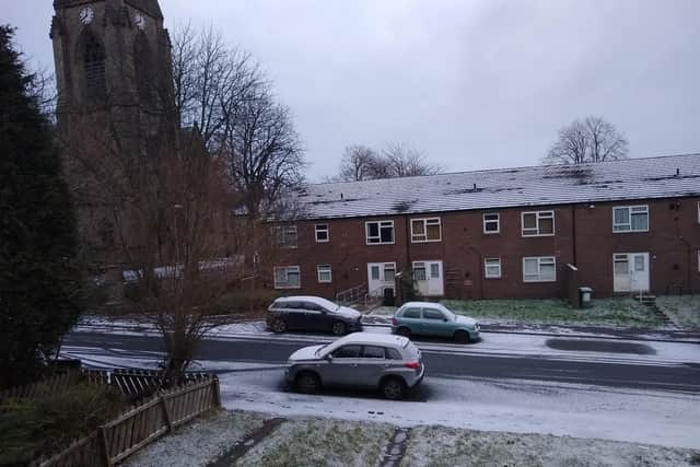
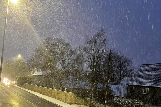
The snow has started to settle in different areas of Leeds already this morning, including Burley and Alwoodley.
It is forecast to get heavier and settle more throughout the day as temperatures are set to plummet below freezing.
Advertisement
Hide AdAdvertisement
Hide Ad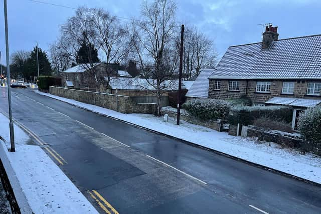

The Met Office has issued a yellow weather warning for snow across Leeds.
It has also said that roads and railways are likely to be affected with longer journey times by road, train and bus services.
There is a small chance of longer travel delays in place with some stranded vehicles and passengers.
Advertisement
Hide AdAdvertisement
Hide AdThe Met Office also warned that there could be some injuries from slips and falls on icy surfaces, with icy patches on some untreated roads, pavements and cycle paths.
There is a small chance that power cuts will occur and other services, such as mobile phone coverage, may be affected.
The Met Office forecast in full for Yorkshire and the Humber:
Monday: Wintry showers throughout today, these giving snow accumulations to all levels. Feeling very cold in the strong northeasterly winds. Temperatures will struggle to reach above freezing. Maximum temperature 2 °C.
Advertisement
Hide AdAdvertisement
Hide AdMonday night: Further snow showers will move west across the region on a moderate easterly breeze, with accumulations to all levels. Feeling very cold overnight with a hard frost and icy conditions. Minimum temperature -5 °C.
Tuesday: Wintry showers continuing but becoming fewer. Icy stretches remain likely with bitterly cold fresh easterly winds. Some winter sunshine between showers. Another hard overnight frost. Maximum temperature 2 °C.
Outlook for Wednesday to Friday: Wintry showers initially on Wednesday, becoming light then clearing later. Drier and bright on Thursday, with a risk of snow again Friday. Bitterly cold with hard frosts and icy stretches.
How to drive safely in snow
- Slow down
Advertisement
Hide AdAdvertisement
Hide AdSnow, ice and water on the road reduce grip and, coupled with poor visibility in bad weather, they mean it’s essential that you cut your speed.
Stopping distances can be 10 times greater in snow and ice so slowing down gives you more time to react to other traffic or hazards on the road ahead.
However, be careful that you don’t drive so slowly that you risk losing momentum. On snow-covered roads and especially on hills this could see you stuck and struggling to get moving again.
- Keep it smooth
As well as keeping your speed down you need to keep your inputs smooth. Sharp acceleration, braking or steering are more likely to cause your car to lose grip, leaving you with no control.
Advertisement
Hide AdAdvertisement
Hide AdWhere you can, try to use engine braking to slow down, that way you’re less likely to skid.
- Leave more space
With stopping distances seriously increased by slippy conditions it’s vital you leave more space between your car and the vehicle in front.
It’s also important to try and anticipate what other drivers are doing - being properly aware could save you from a crash or being stranded as others grind to a halt. It also means you're less likely to have to brake or steer suddenly.
- Use a high gear
If your car is struggling to find grip, especially when pulling away, trying selecting a higher gear. This should reduce the amount of wheelspin and help you get moving.
- Stay seen
Advertisement
Hide AdAdvertisement
Hide AdWith shorter days and the prospect of rain, fog or snow making visibility worse, it's important to make sure you can see and be seen. Check all your lights work and are clear of snow or ice before setting off.
Don't wait until it's pitch black to use your headlights and don't just rely on running lights when conditions deteriorate. If it's snowing heavily, dipped beams may actually work better than full beams.