'˜Yellow warning' of snow across Yorkshire tonight


Forecasters say outbreaks of rain and sleet, with snow over hills will spread east, before increasingly turning to snow in places.
The trend to wintry weather then extends into parts of northern England during the rest of Wednesday night, clearing from Yorkshire during the morning. At this stage, it looks as if the heaviest snow will affect parts of southern Scotland and upland areas of northern England, including cross-Pennine routes, where 3 to 6 cm may fall in a number of areas, with possibly as much as 10 cm locally, mainly above elevations of 300 metres.
Tonight:
Advertisement
Hide AdAdvertisement
Hide Ad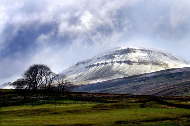
Cold and cloudy with rain, sleet or snow. Several centimetres are expected over Pennines, but rain is more likely near coasts later as strong to gale northeasterly winds develop. Minimum Temperature 1°C.
Thursday:
Cloud and morning wintry precipitation will clear to leave a cold and sunny day. A few wintry showers will form over hills later. Cold northerly winds. Frosty overnight. Maximum Temperature 2°C.
Outlook for Friday to Sunday:
Cold, brisk northerly winds with sunshine on Friday, perhaps isolated wintry showers over Pennines. Occasionally wintry showers on Saturday. Sunny spells on Sunday with possible coastal showers. Overnight frosts throughout.